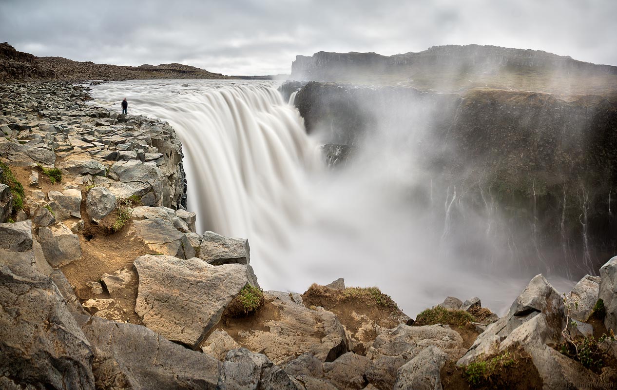
This is a long exposure at Dettifoss. It was taken with a neutral density filter and the 18-55 kit lens at 18 mm. As the exposure time is 4 seconds I also used a tripod. The image is stitched from three images in portrait mode. I used an additional image for the guy standing at the waterfall. The resulting image is 9492 x 6000 pixels.
Dettifoss is a large waterfall in the north of Iceland. In fact it is said that this is the most powerfull waterfall in Europe. The waterfall is 100 meters (330 ft) wide and drop about 45 meters (150 ft) at this location.
Víti (which is icelandic for ‘hell’) is a crater lake in the vulcanic area of the Krafla vulcano. The diameter is about 330 meters. The crater was formed by a steam eruption in 1724.
Hverarönð is a geothermal area east of the mountain Námafjall in the north of Iceland. It is part of the volcanic system of the Krafla volcano which is lokated about 8 km (5 miles) to the north.
This is one of the rare occasions where I can provide an image, which documents the making of the panorama.
Shooting a horizontal pole panorama
I took six images with a fisheye lens. After taking an image the pole was rotated about 60° before I took the next image. As the images were taken with a fisheye lens we were visible in the “nadir” of the final panorama. I retouched “nadir” and “zenith” manually in Photoshop. The real nadir and zenith were left unt(re-)touched as one shot was facing up and one was facing down.
This image shows a hot mud pot in the Hverarönð geothermal area. The area is part of the volcanic system of the Krafla volcano which is lokated about 8 km (5 miles) to the north.
This turf farm consists of 14 clustered houses. The site has been inhabited for centuries, and the farm is mentioned several times in the medieval Saga literature. Today it is a museum.
This turf church is one of only six icelandic turf churches still standing. They are preserved as historical monuments. This church was built 1834 and has turf walls, but timber gables both back and front.
Skálholtdómkirkja is the icelandic term for ‘Cathedral of Skálholt’. It was errected between 1956 an 1963. It is located at Skálholt, a site which hosted a bishop 800 years.
The Gullfoss (which means Golden Falls in icelandic) is a waterfall in the canyon of the river Hvítá in the southwest of Iceland. The waterfall is one of the most popular tourist attractions in Iceland.
 Show on map
