This image is from the September page of my 2018 calender.
 Show on map
This is the blog of the PanoTwins
Interactive 360° or partial panoramas in cylindrical projection.
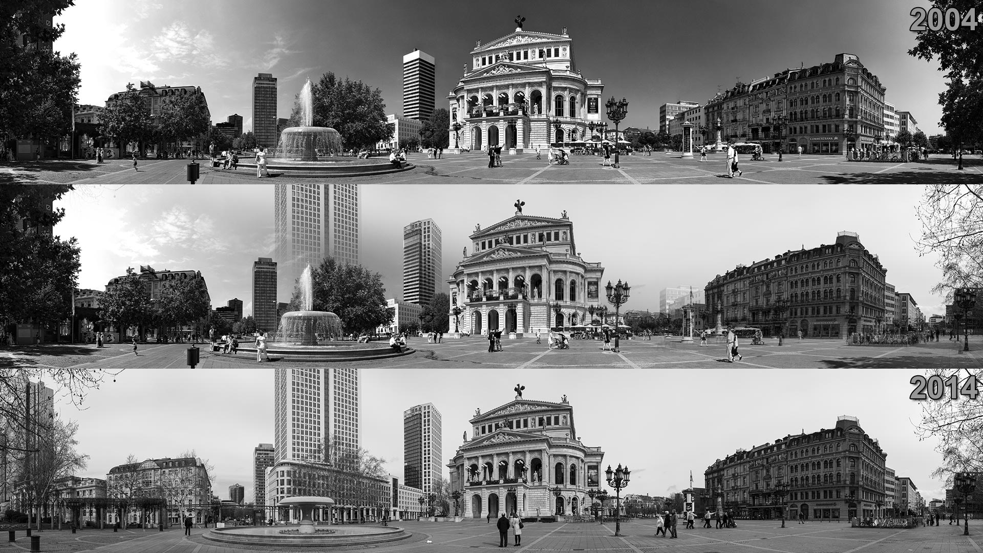
The upcoming World Wide Panorama (WWP) event is entitled ‘decade’.
In the time frame of a decade even a city can change it’s appearance. So I searched for panoramic images which I shot in 2004 and which were shot at a place which changed over the last ten years. The best example was a image of the Opernplatz, which I took back in 2004 as a cylindrical panorama. And the view of the Opernplatz (which translates to ‘the square of the opera’) indeed changed a lot in the last ten years.
So I went back and stood at the same spot where I stood a decade ago. First I took a spherical panorama with my double monopod construction. Afterwards I did a remake of the original cylindrical panorama. The following image shows the two cylindrical panoramas in a single composite.
 Show on map
The original panorama from 2004 is also available on the blog.
This year I entered some images for the Epson International Pano Awards. In the fourth year of the competition I was awarded with two silver awards. All the other images were awarded with a bronze award.
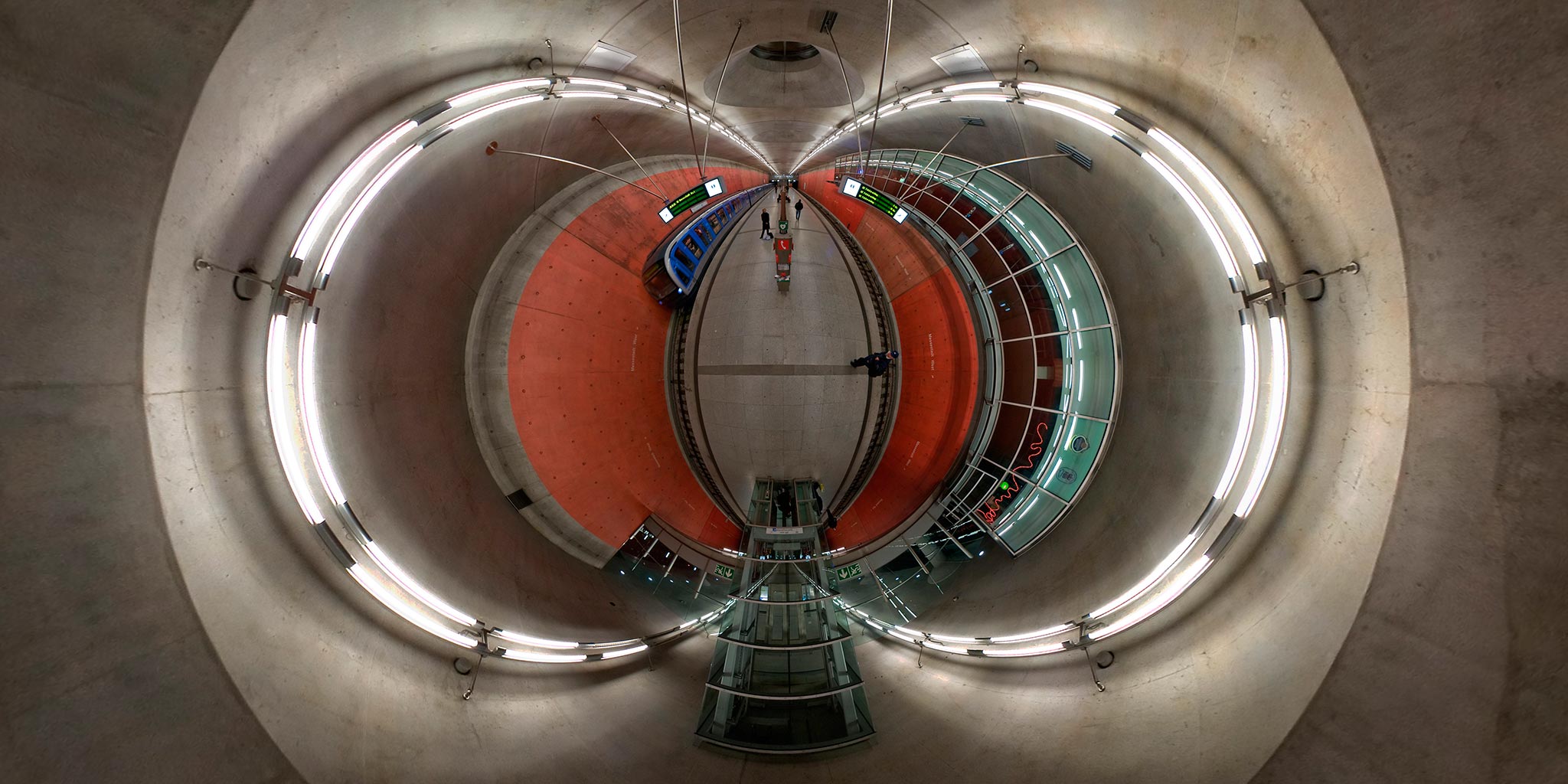
The first silver award was assigned for the following reprojection of this spherical panorama. It reached the 40th place in the category ‘The Built Environment – Open Award‘.
The second silver award was assigned to the following image. It reached the 11th place in the category ‘Nature – Amateur Award‘.
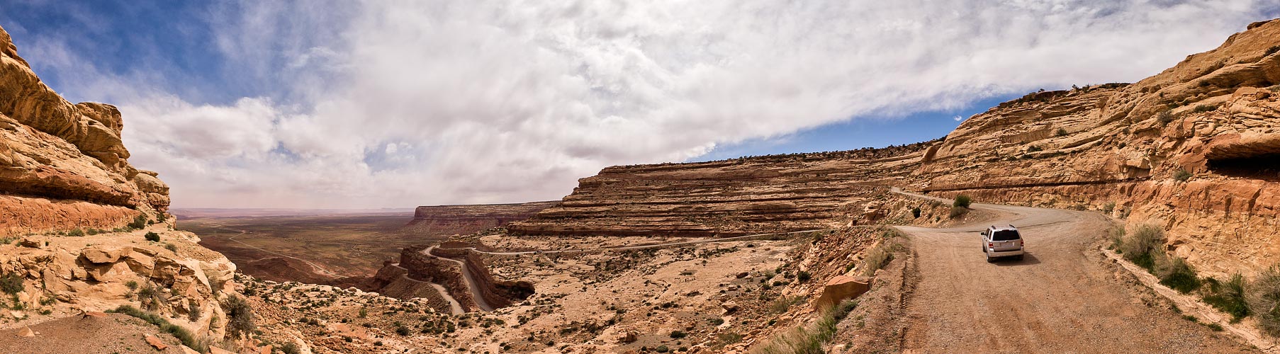
The Moki Dugway is a section of the Utah state route 261. The winding road descends a height of approx. 335 m (1,100 ft) over a length of 4.8 km (3 miles).
This image is a cropped and tuned version of this spherical image.
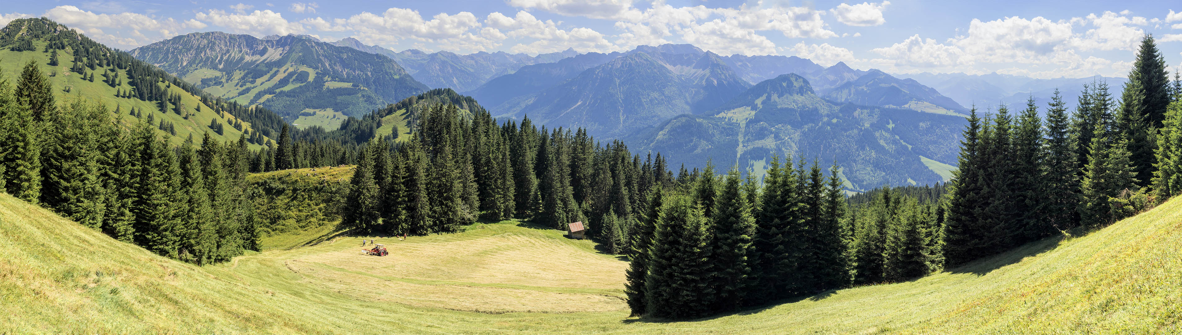
This panorama shows the view from near the summit of mount Baoleskopf towards the valley Ostrachtal. On the left ist the Oberjoch with the mountains Spießer ans Iseler.
I took nine images in portrait orientation. The final panorama has a size of 19752×5600 pixel.
Show on map
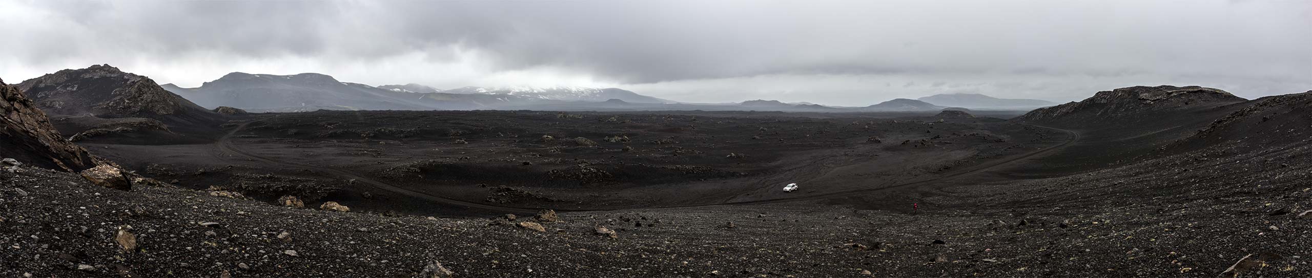
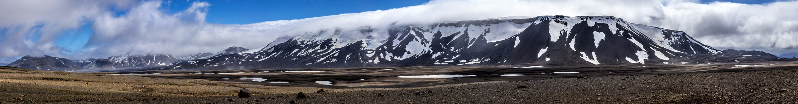
When you drive north of the volcano Hekla towards the area of Landmannalaugar you almost feel like being on the Moon. However I’m not completely sure, because I’ve not yet been to the Moon 😉
Show on map
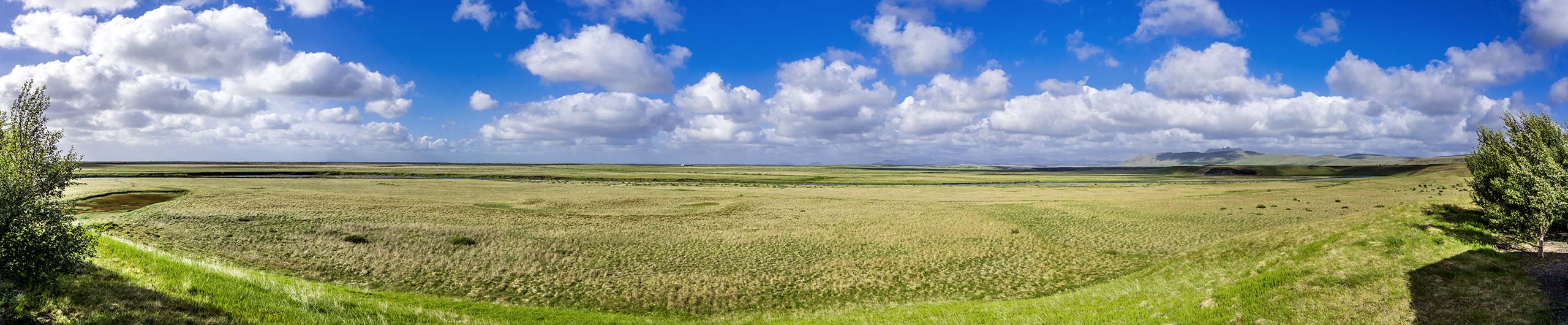
During the day the weather was mostly cloudy and rainy, however in the evening the sun came out and shone over the river Eystri-Rangá.
Show on map
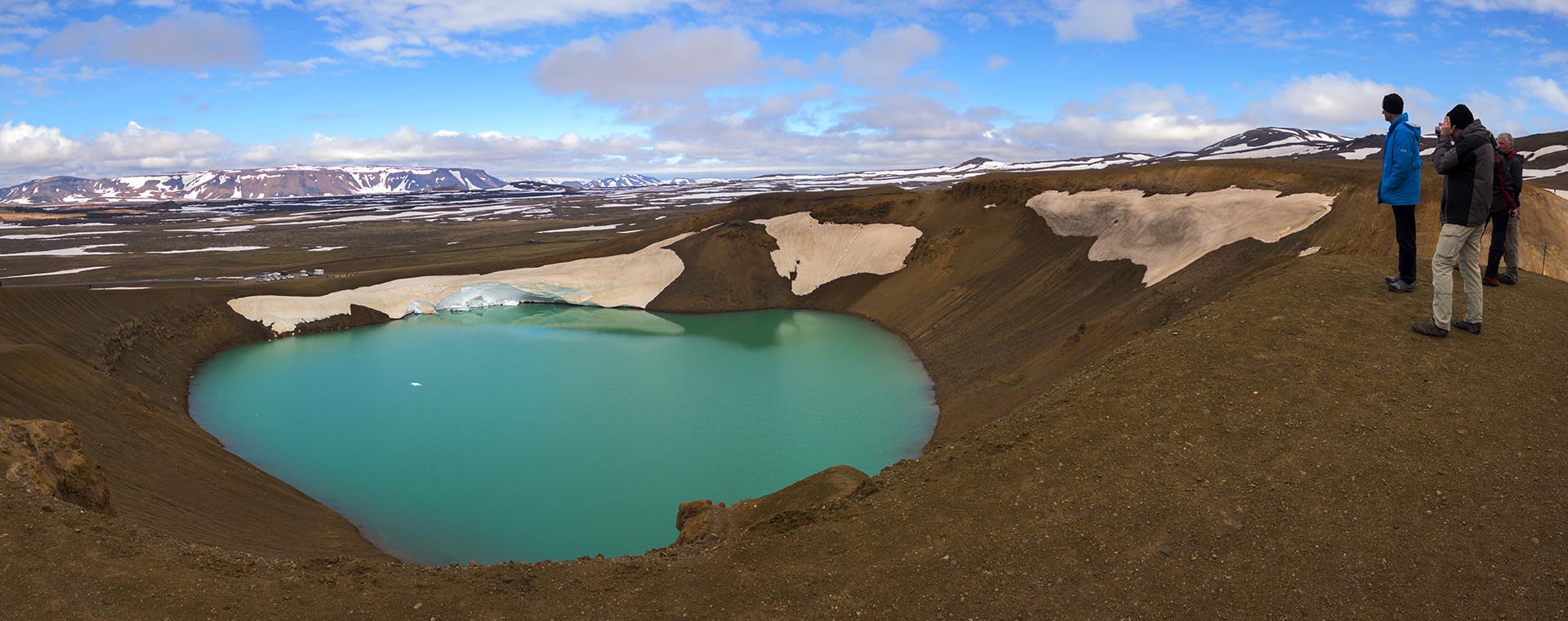
Víti (which is icelandic for ‘hell’) is a crater lake in the vulcanic area of the Krafla vulcano. The diameter is about 330 meters. The crater was formed by a steam eruption in 1724.
Show on map
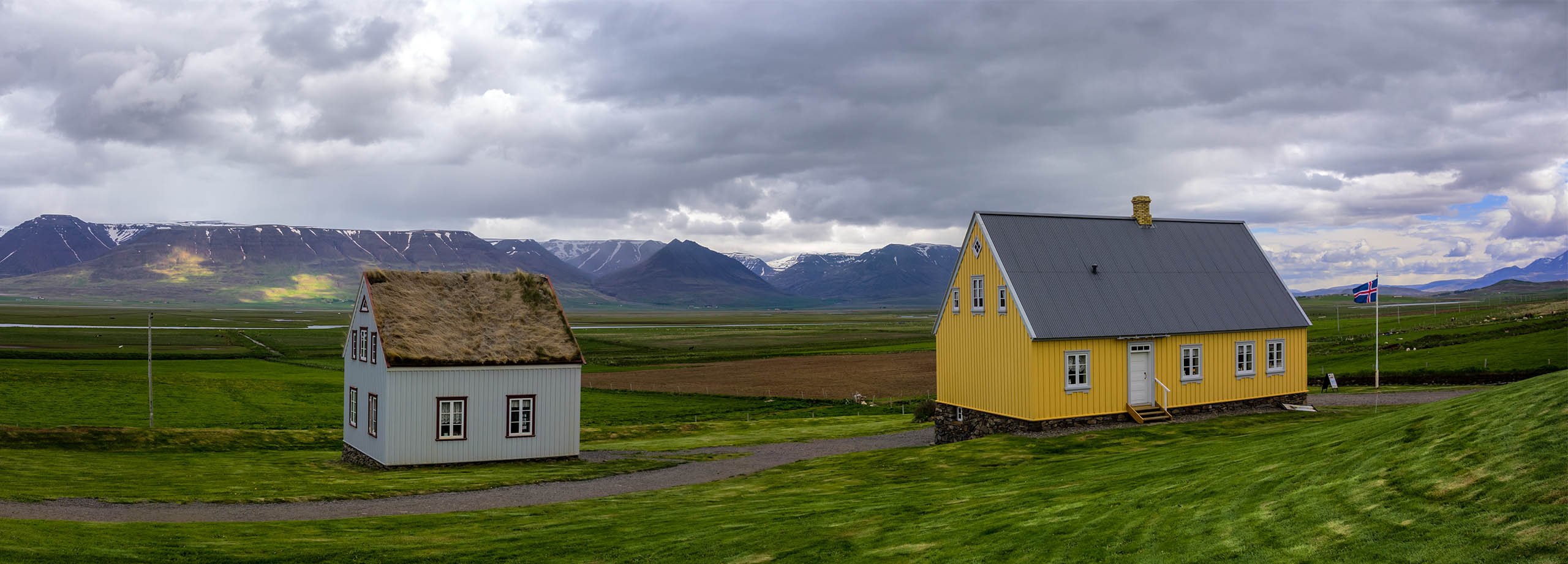
The Glaumbær farm is a museum that gives you a really interesting perspective on how the poeple lived in former times in Iceland.
Show on map
This view is towards þórisjökull while driving through Kaldidalur.
Show on map