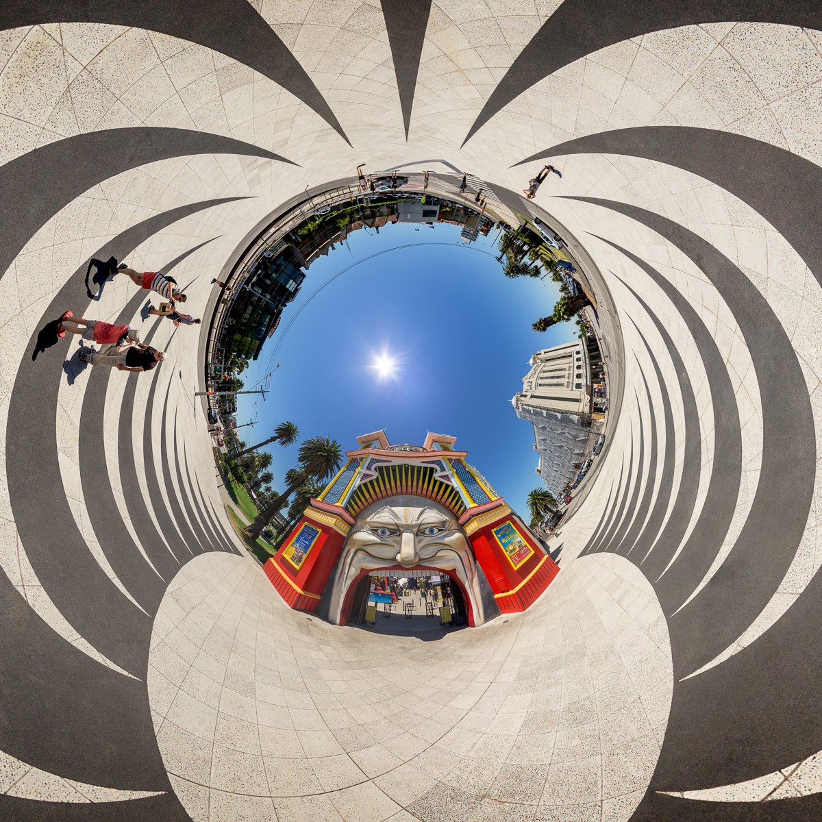
This image is from the December page of my 2018 calender. The reprojected panorama shows the entry of Melbourne’s Luna Park. Reprojection is tunnel (stereographic up).
 Show on map
This is the blog of the PanoTwins
This image is from the December page of my 2018 calender. The reprojected panorama shows the entry of Melbourne’s Luna Park. Reprojection is tunnel (stereographic up).
Show on map
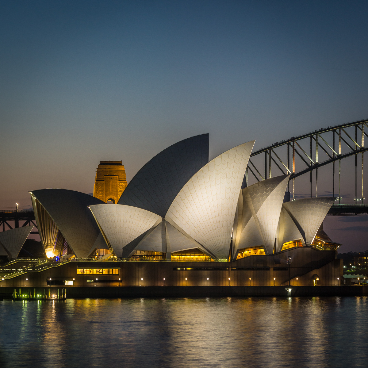
This image is from the November page of my 2018 calender. It shows a long exposure (25s) in Sydney. It features the iconic landmark Sydney Opera.
 Show on map
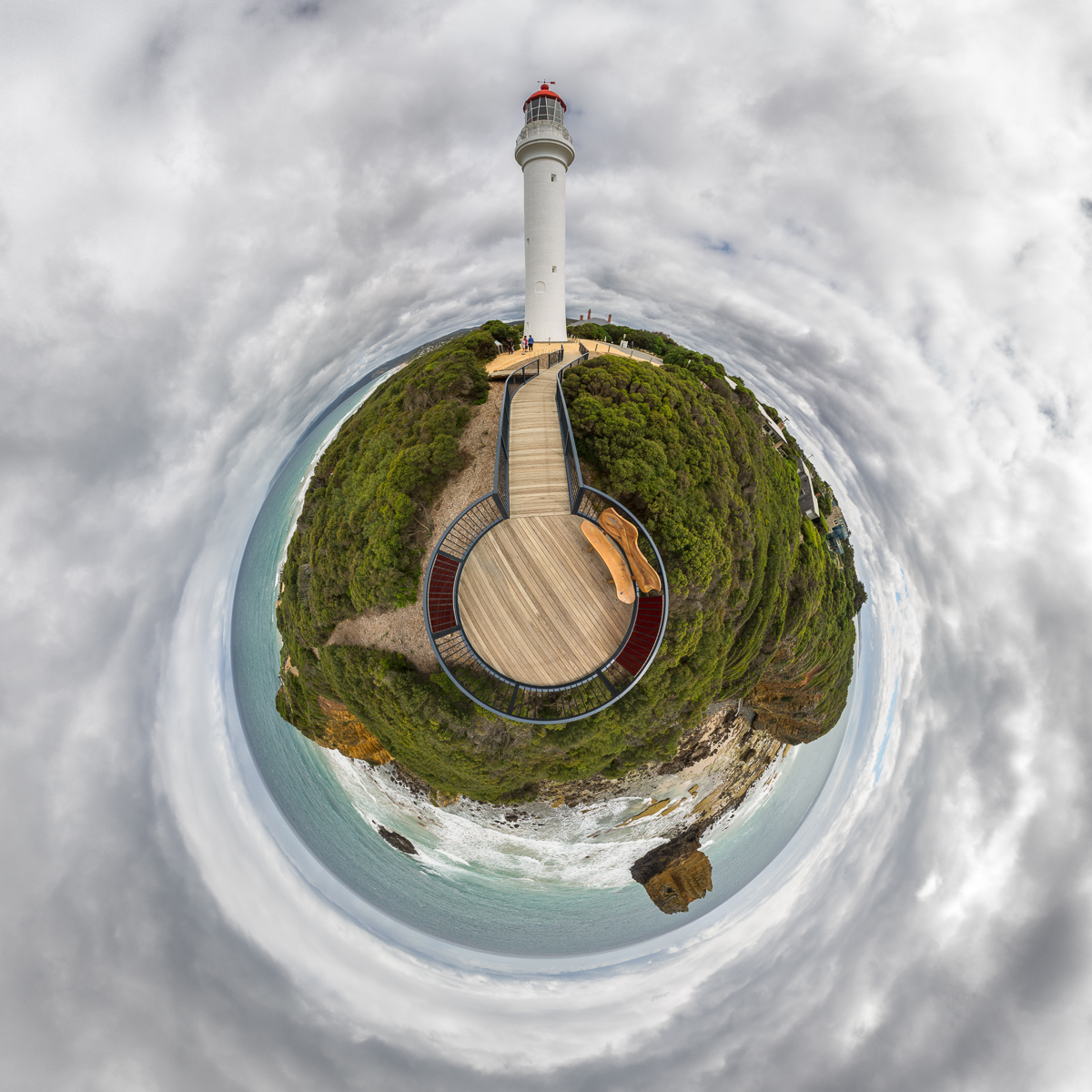
This image is from the April page of my 2018 calender. This reprojected spherical panorama shows Split Point Lighthouse from the viewing platform near the cliff.
 Show on map
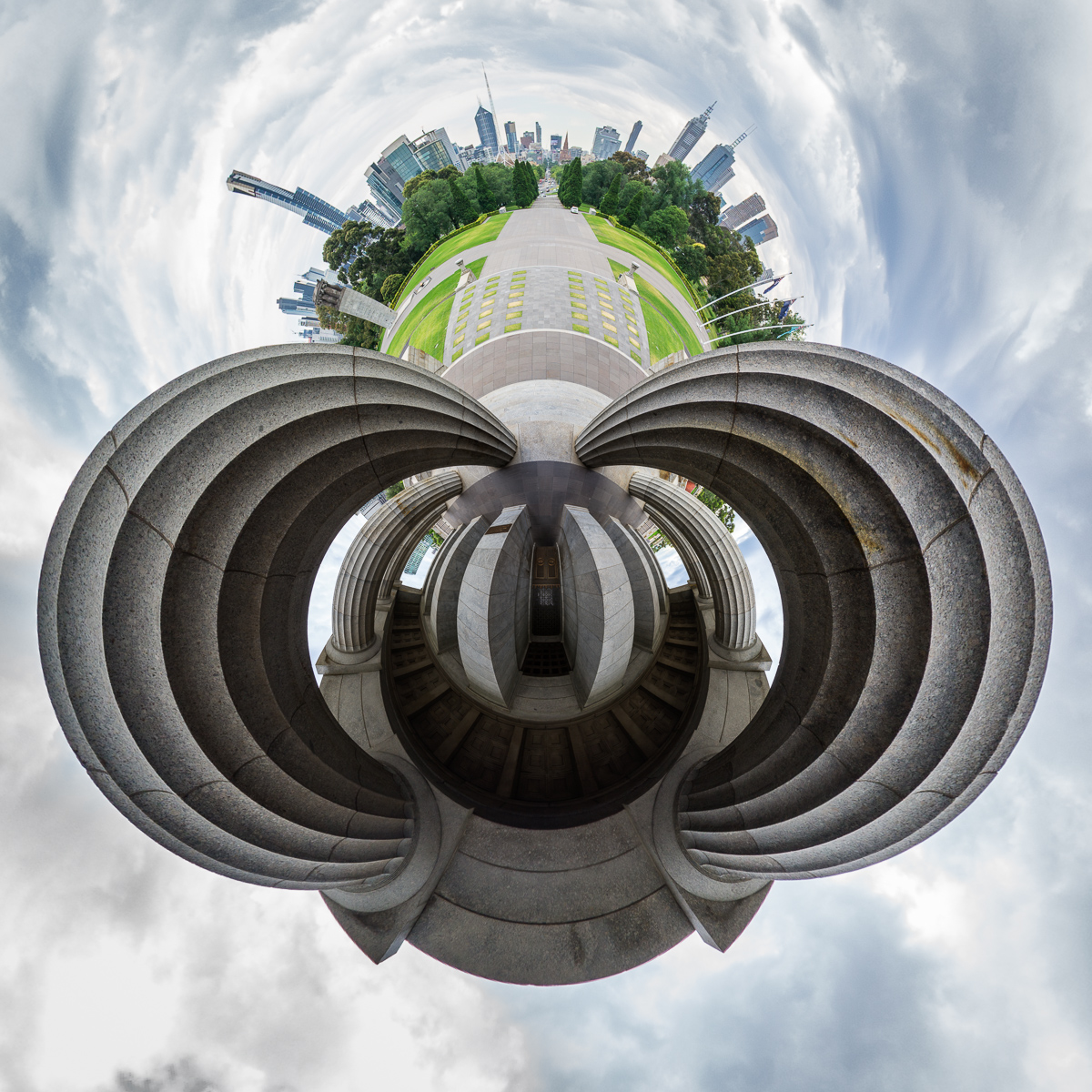
This image is from the February page of my 2018 calender. This image shows a reprojected spherical panorama which was taken in front of the entrance of the Shrine of Remembrance. Reprojection is little planet (stereographic).
‘Larry’ is a 17 m tall sculpture of a spiny lobster. It is made of steel and fibreglass and was built in 1979 in a period of six month. It has an approximate weight of about 4 tonnes.
Technique:
The shooting was done with a 2.60 meter (appx. 8.5 ft) pole to reach a more elevated viewpoint. The lens was mounted with a custom-made bracket. Stitched from five images taken with a Walimex (Samyang) 7.5mm fish eye lens on a Sony QX1. Four images around and an additional image for the nadir. The zenith was retouched by hand in post-processing.
This panorama was shot on a small beach west of Beachport.
Technique:
The shooting was done with a 2.60 meter (appx. 8.5 ft) pole to reach a more elevated viewpoint. The lens was mounted with a custom-made bracket. Stitched from six images taken with a Walimex (Samyang) 7.5mm fish eye lens on a Sony QX1. Five images around and an additional image for the nadir. The zenith was retouched by hand in post-processing.
This panorama shows the Umpherston Sinkhole. I was standing on the ground of the sinkhole while I was taking the panorama.
Technique
The shooting was done with a 2.60 meter (appx. 8.5 ft) pole to reach a more elevated viewpoint. The lens was mounted with a custom-made bracket. Stitched from five images taken with a Walimex (Samyang) 7.5mm fish eye lens on a Sony QX1. Four images around and an additional image for the nadir. The zenith was retouched by hand in post-processing.
The Petrified Forest is an area with structures of stone which look like petrified trunks of trees. The area is part of the Discovery Bay Coastal Park in Victoria (Australia). It can be accessed via the Blowholes Road. There are different theories about the origin of the structures, but it is said to be sure that these structures are no petrified trees.
Technique
The shooting was done with a 2.60 meter (appx. 8.5 ft) pole to reach a more elevated viewpoint. The lens was mounted with a custom-made bracket. Stitched from five images taken with a Walimex (Samyang) 7.5mm fish eye lens on a Sony QX1. Four images around and an additional image for the nadir. The zenith was retouched by hand in post-processing.
The Tower Hill Wildlife Reserve is one of the many parks in Victoria (AUS). The viewpoint is on top of Tower Hill, which can be reached with a short hike from one of the carparks. The park iself is situated in an ancient volcanic crater.
Technique
The shooting was done with a 2.60 meter (appx. 8.5 ft) pole to reach a more elevated viewpoint. The lens was mounted with a custom-made bracket. Stitched from five images taken with a Walimex (Samyang) 7.5mm fish eye lens on a Sony QX1. Four images around and an additional image for the nadir. The zenith was retouched by hand in post-processing.
This panorama shows one section of Loch Ard Gorge. It can be reached by some steps from the carpark.
Technique
The shooting was done with a 2.60 meter (appx. 8.5 ft) pole to reach a more elevated viewpoint. The lens was mounted with a custom-made bracket. Stitched from five images taken with a Walimex (Samyang) 7.5mm fish eye lens on a Sony QX1. Four images around and an additional image for the nadir. The zenith was retouched by hand in post-processing.