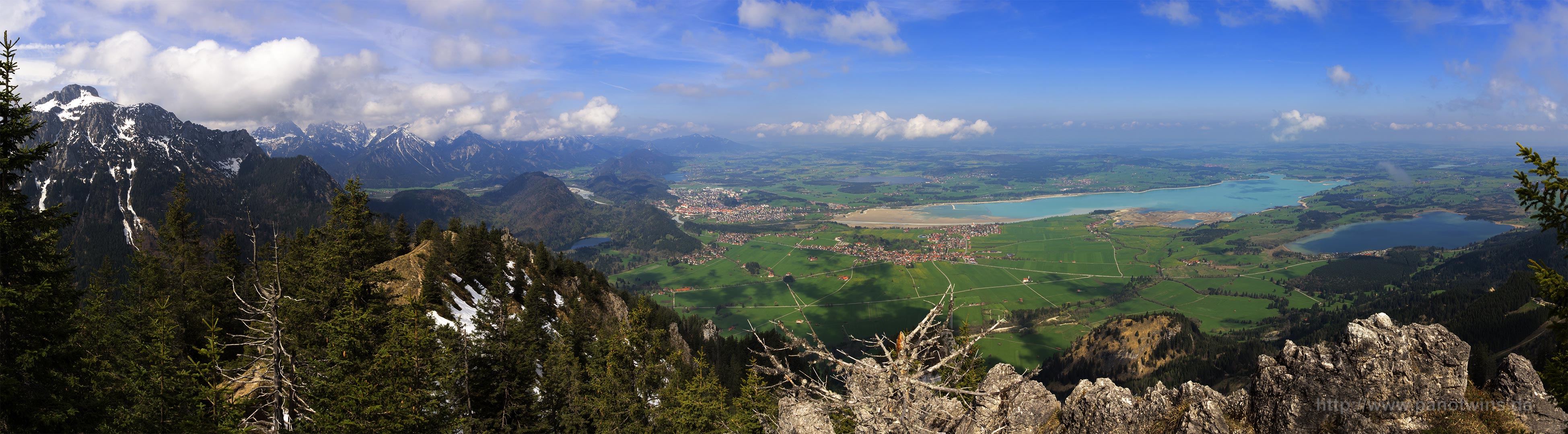
This is the view from Tegelberg down towards Füssen and the Forgggensee. When viewing the image use the F- Key to see the full resolution!
 Show on map
This is the blog of the PanoTwins
This is the view from Tegelberg down towards Füssen and the Forgggensee. When viewing the image use the F- Key to see the full resolution!
Show on map
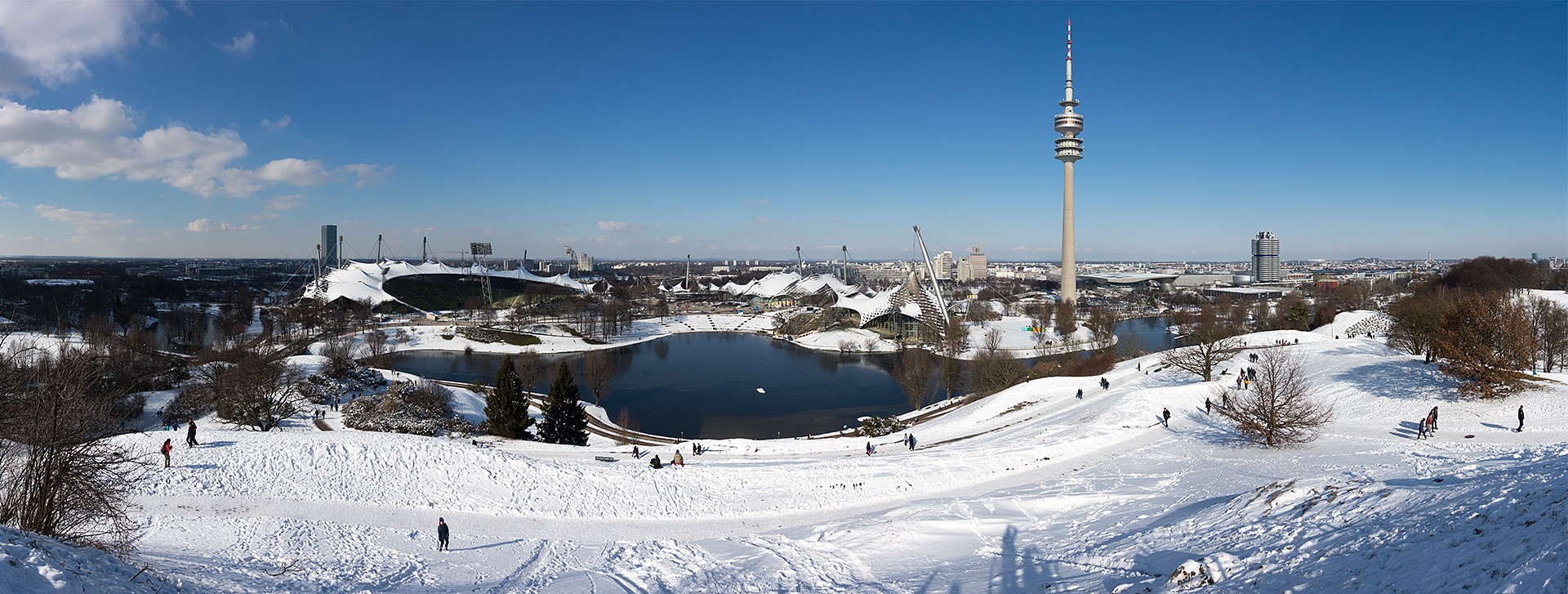
This panorama has been taken from the viewpoint in Munich’s Olympic Park. I used nine images taken with the Sony DSC-RX100 in portrait mode. The original panorama has a size of 12869×4870 pixels. I scaled this one down to a width of 1920 pixels.
Show on map
This panorama shows a building in Wolfratshausen’s cemetery where urns are buried. It is more like a small room with urns on the walls.
[pano file=”https://www.panotwins.de/wp-content/panos/MMatern_20130123_1902_WOR_FriedhofUrnenKammer.xml” preview=”https://www.panotwins.de/wp-content/panos/MMatern_20130123_1902_WOR_FriedhofUrnenKammer.jpg”]
Show on map
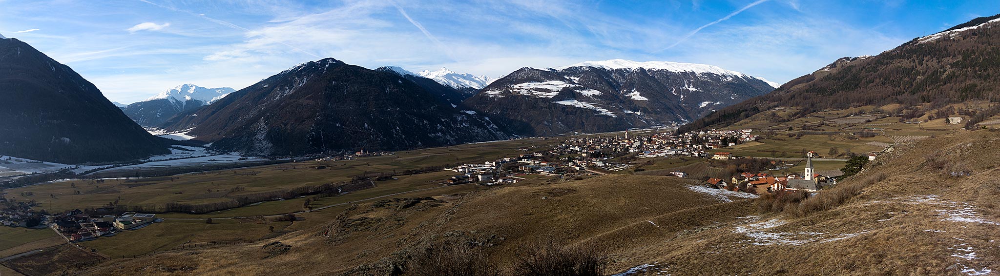
On the “Tartscher Bühel” you have a nice view over the upper part of the Vinschgau. I created the panorama using four landscape images taken with the Sony DSC-RX 100. The final (maximum) resolution of the panorama is 11000×3038 pixel.
Show on map
The Reschensee (Italian: Lago di Resia) is an artificial lake in South Tyrol (Italy). The lake is famous for the steeple of a 14th century church which was submerged, when the lake was flooded. When the lake freezes the steeple can be reached by foot.

Show on map
This panorama is a tribute to Joseph von Fraunhofer (* March 6, 1787 – † June 7, 1826) a German physicist and optician. He was born in Straubing and died in Munich. This panorama shows his tomb in Munich. I shot this panorama at his tomb almost eight years ago!
[pano file=”https://www.panotwins.de/wp-content/panos/MMatern_20121110_2879_FraunhofersTomb.xml” preview=”https://www.panotwins.de/wp-content/panos/MMatern_20121110_2879_FraunhofersTomb.jpg”]
Show on map
This panorama has been stitched from five images in portrait orientation. The final rendered image had a resolution of 10000×5088 pixel.
Show on map
The name of the alp you see here roughly translates to “Hindmost Colossus Alp”. It is found in the Retterschwang valley near Bad Hindelang. Cycling from Bad Hindelang brings you from 800m to the alp at 1451m in about 10km distance. You should use a mountain bike with the appropriate gears!
[pano file=”https://www.panotwins.de/wp-content/panos/MMatern_20120801_0071_Entschenalpe.xml” preview=”https://www.panotwins.de/wp-content/panos/MMatern_20120801_0071_Entschenalpe.jpg”]
Show on map
North of Bad Hindelang arises the Hirschberg. It is a mountain, that is 1500m high. Near the cross is a beautiful viewpoint to the valley of Bad Hindelang, Bad Oberforf and also towards Oberjoch.
[pano file=”https://www.panotwins.de/wp-content/panos/MMatern_20120731_0034_GipfelkreuzHirschberg.xml” preview=”https://www.panotwins.de/wp-content/panos/MMatern_20120731_0034_GipfelkreuzHirschberg.jpg”]
Show on map
I recently bought the SEL55210 lens from Sony. This image shows one of my first panoramas I made with the lens. The original image dimensions are 27000×6084 pixel. I took 34 images in two rows @55 mm handheld.
