This panorama was stitched from six images in landscape orientation. The resulting panorama is 10800 x 5585 pixels. Despite the fact that it was taken through a tinted window, I’m quite pleased with the final result.
 Show on map
This is the blog of the PanoTwins
This panorama was stitched from six images in landscape orientation. The resulting panorama is 10800 x 5585 pixels. Despite the fact that it was taken through a tinted window, I’m quite pleased with the final result.
Show on map
This panorama shows the atrium of the Bavarian Ministry of Justice in Munich.
[pano file=”https://www.panotwins.de/wp-content/panos/MMatern_20140107_1741_Justizpalast_Halle.xml” preview=”https://www.panotwins.de/wp-content/panos/MMatern_20140107_1741_Justizpalast_Halle.jpg”]
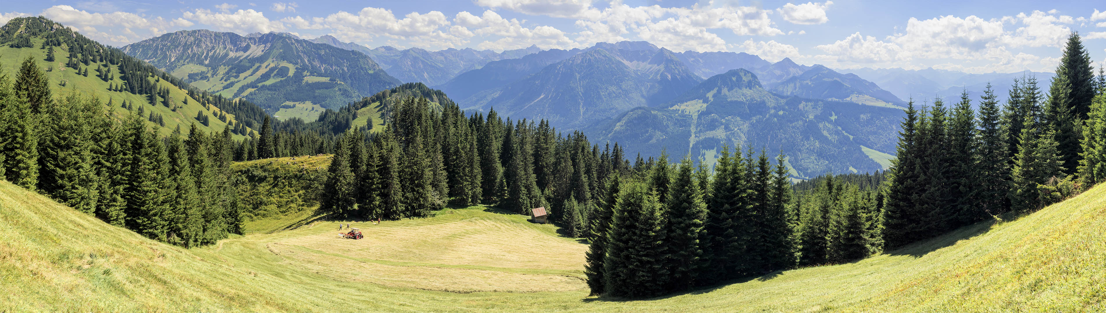
This panorama shows the view from near the summit of mount Baoleskopf towards the valley Ostrachtal. On the left ist the Oberjoch with the mountains Spießer ans Iseler.
I took nine images in portrait orientation. The final panorama has a size of 19752×5600 pixel.
Show on map
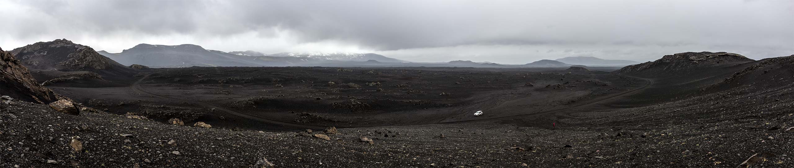
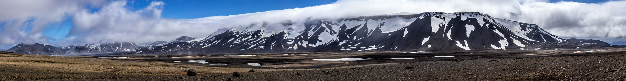
When you drive north of the volcano Hekla towards the area of Landmannalaugar you almost feel like being on the Moon. However I’m not completely sure, because I’ve not yet been to the Moon 😉
Show on map
During the day the weather was mostly cloudy and rainy, however in the evening the sun came out and shone over the river Eystri-Rangá.
Show on map
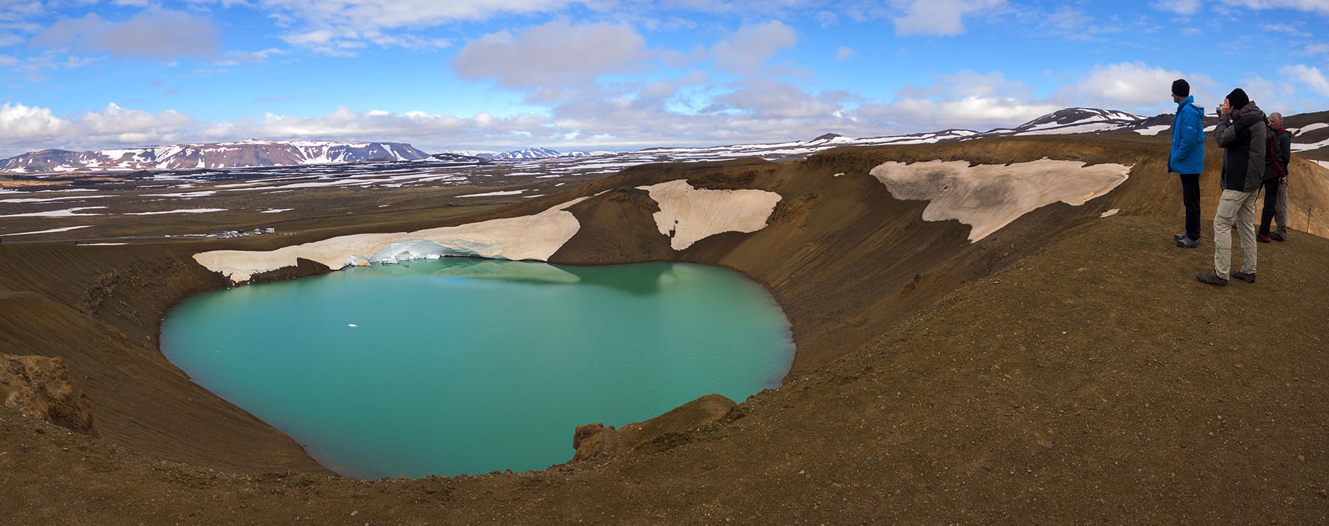
Víti (which is icelandic for ‘hell’) is a crater lake in the vulcanic area of the Krafla vulcano. The diameter is about 330 meters. The crater was formed by a steam eruption in 1724.
Show on map
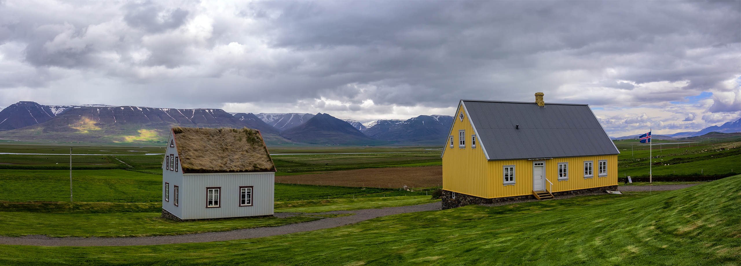
The Glaumbær farm is a museum that gives you a really interesting perspective on how the poeple lived in former times in Iceland.
Show on map
This view is towards þórisjökull while driving through Kaldidalur.
Show on map
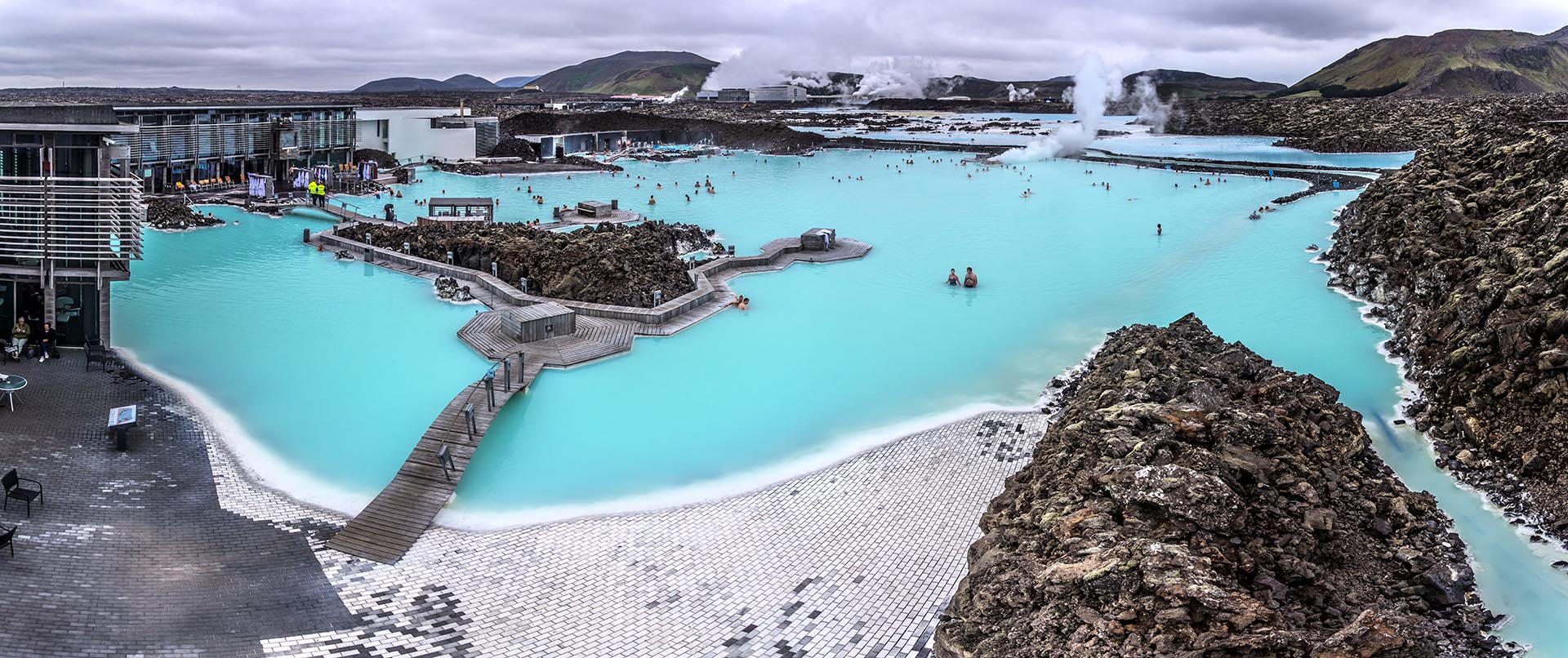
The Blue Lagoon (Bláa Lónið in icelandic) is a geothermal spa in the south western part of Iceland. It is considered as one of the most visited tourist attractions in Iceland.
Show on map
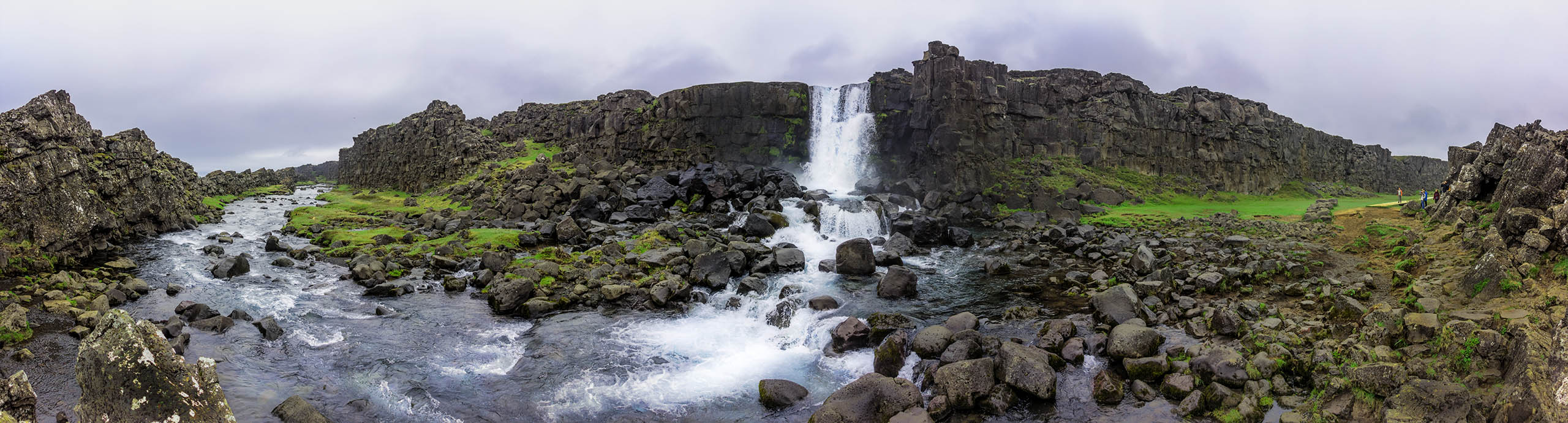
Öxarárfoss is a waterfall in Iceland and very close to one of Iceland’s well known tourist attractions: Þingvellir. This is a National Park and the area where around 930 poeple from Iceland started to gather for their first Parliament. They did this there until 1798. The bed of river Öxarár has been changed to supply the gathering masses with water in times of their gathering.
Show on map