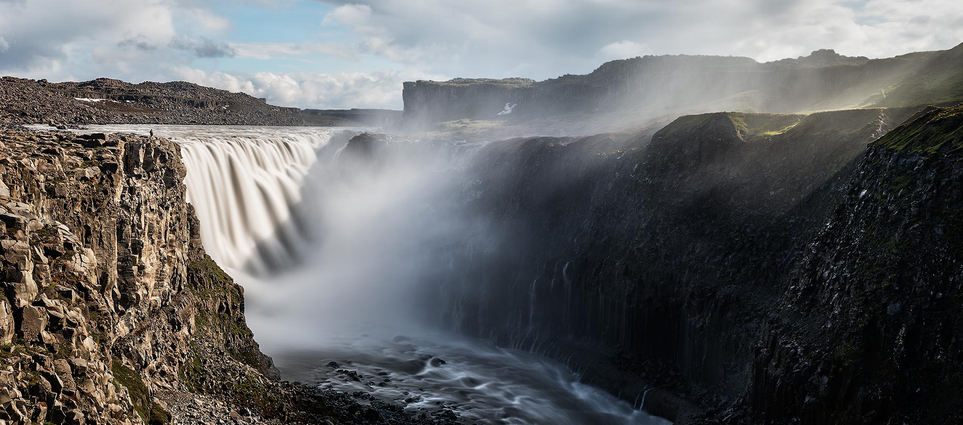
This panoramic image was stitched from five images in portrait orientation. I used a neutral density filter with 10 f-stops to get an exposure of 8 seconds.
 Show on map
Category: Pano Rectilinear Projection
Panoramas in rectilinear projection.
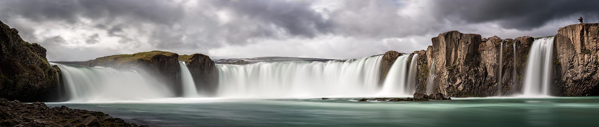
Long time exposure at Goðafoss (at day)
This image is a panoramic image in rectilinear projection. It’s stitched from 4 images in landscape orientation. Each of the images was taken with a neutral density filter (10 f-stops) to get an exposure time of 8 seconds.
Show on map
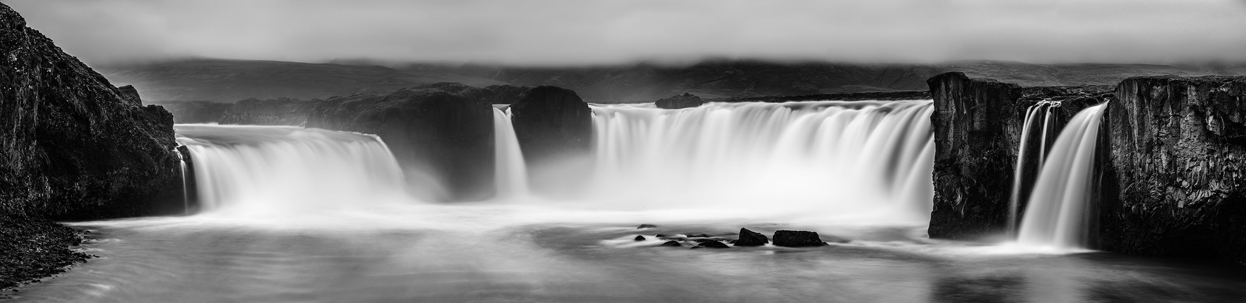
Long time exposure at Goðafoss (at night)
This image is a panoramic image in rectilinear projection. It’s stitched from 10 images in portrait orientation. Each of the images was taken with a neutral density filter (10 f-stops) to get an exposure time of 15 seconds.
Show on map
Raw Recovery with ‘Oloneo Photo Engine’
Yesterday I presented a somewhat older panoramic image from 2006. Usually I don’t need that much time to reach a result which matches my vision. My standard workflow for panoramic images starts with loading all the files in the raw converter. I choose a common white balance for all images and unify exposure, shadows, and other parameters which have to be identical among every source image. After stitching I got the following result:
")
I was really disappointed. In my imagination the view just was stunning. But what I saw on the screen was really dull and boring. I tried to achieve a better result with adding masks and doing some dodging and burning, but I didn’t reach my goal of a spectacular image. So I left the files on the harddisk and they were buried in oblivion.
Recently I purchased Olonoe Photo Engine in order to use it for my high dynamic range workflow of spherical panoramas. Independently of that fact, I was recently crawling through the sphericals of our website and I stumbled upon the panorama PanoTwin Jürgen shooting Castle Rock. So I browsed my database for the images and found the long forgotten files of Castle Rock on my hardddisk. Immediately I realised that this image is a good candidate for the mode ‘raw recovery’ of Olonoe Photo Engine. So here is the result after playing a bit with the parameters:
")
So I choose the ‘raw recovered’ image as new base image of my tweaks. Again I applied some dodging and burning, but now the image matched my vision when I was standing at the coast of Lynton and looking towards Castle Rock. And this is the final result:
")
As Olonoe Photo Engine is capable of processing TIFF images with a bit depth of 16bit, be sure to start your panoramic imagery with images in RAW mode of your camera. And for best results stick to a full 16bit workflow.
Show on map
Castle Rock near Lynton (Devon, England)
Nearly six years ago we’ve been at the Panotools-Meeting in Bath. After the sessions we toured the south-west of England four another two weeks. And while taking a little hike near Lynton I took this panorama. And finally today I consider this image as completely post-processed 🙂
Panotwin Markus made a spherical while I was shooting a mosaic of this view. Back in 2006 I used a Konica Minolta Dynax 7D which had 6 Megapixel. As the shot was hand-held and I wanted to make sure not to forget some portions of the view, I chose an overlap of approximately 50%. So I ended up with 20 images (4 columns with 5 rows in landscape orientation). The final panorama has a resolution of only 42 Megapixel. But hey, this was nearly six years ago!
Show on map
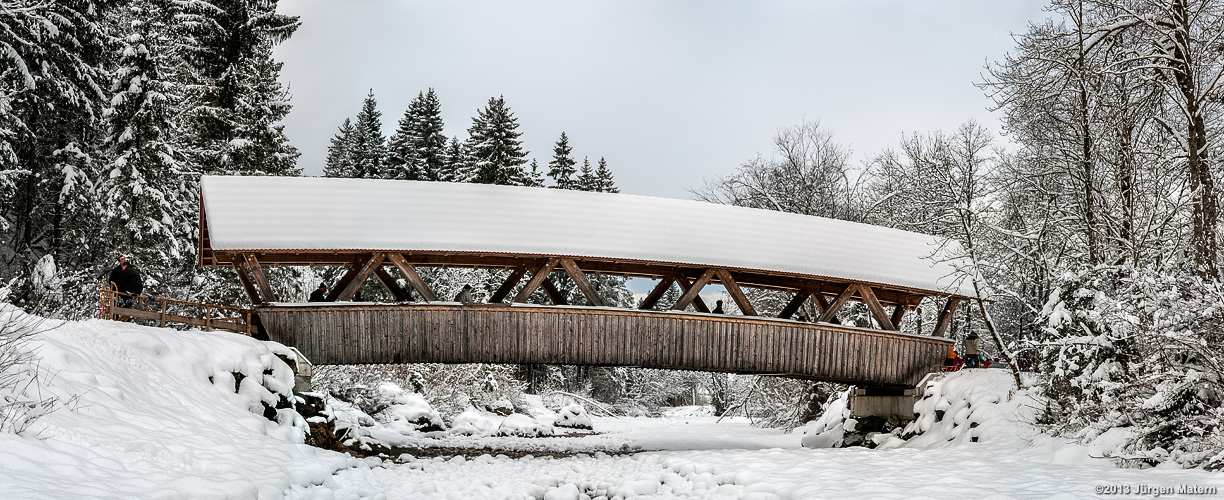
Bridge over the Ostrach near Bad Hindelang in the winter
This is the second panoramic image which I shot with my first DSLR camera. I took eight images in two rows in landscape orientation. The size of the resulting image is 9080 x 3709 pixel.
 Show on map
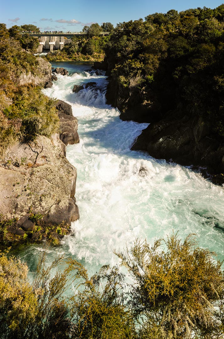
Panorama at Aratiatia Rapids
Despite the resolution of only 5 megapixels of one of the original images the stitched image has 55 megapixel due to its high number of source images. For this panorama I used 22 images in landscape orientation.
The Aratiatia Rapids are flooded every two hours from the dammed section of the Waikato river.
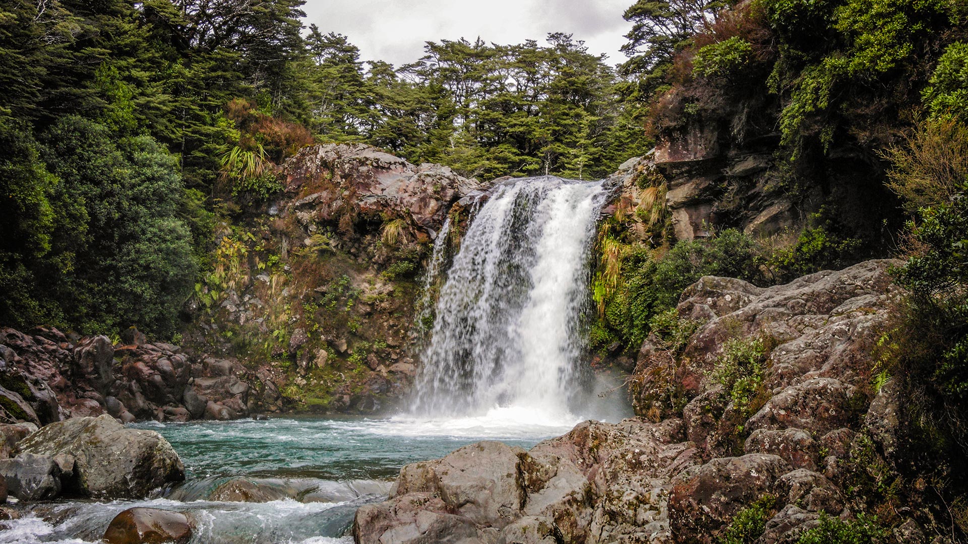
Tawhai Falls in Tongariro National Park
This panorama was stitched from three images in landscape orientation. Each of the original images has 5 megapixel. The resolution of the final image is 5120 pixel by 2880 pixel.
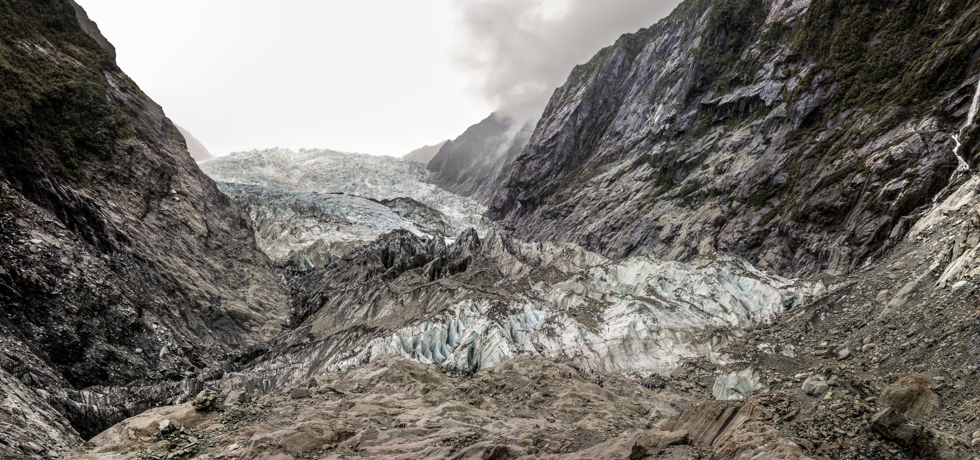
Standing at the Franz-Josef-Glacier in New Zealand (2004)
This image was stitched from eleven images in mixed orientation (landscape and portrait). The final image is 7033 x 3303 pixels
Show on map