This year we started with a photographic experiment. We recruited two assistants and used some sparklers to write 2012 in the air.

With this image we wish you happiness, luck and health for 2012. And of course a lot of new panoramic images 🙂
This is the blog of the PanoTwins
This year we started with a photographic experiment. We recruited two assistants and used some sparklers to write 2012 in the air.
With this image we wish you happiness, luck and health for 2012. And of course a lot of new panoramic images 🙂
The upcoming event at the WWP is named “history”. As I’m a regular contributor I also wanted to contribute for this event.
After a discussion with a friend of mine I decided to realize an idea which took shape in my mind quite some time ago. I wanted to integrate a picture which shows a historic point in time in a panorama which shows the actual scenery.
Here is the panorama of the actual scenery.
[pano file=”https://www.panotwins.de/wp-content/panos/JMatern_110919_5673-5682_FS.xml” preview=”https://www.panotwins.de/wp-content/panos/JMatern_110919_5673-5682_FS.jpg”]
And this is the historic image I wanted to integrate.

The combined panorama is hosted at the history event of the the world wide panorama.
 Show on map
Some weeks ago a question came up, whether it is possible to stitch a panorama from so called sweep panoramas made with the Sony NEX-5. The short answer is: NO. You can read the detailed answers in my two recent posts: #1 and #2.
 Here is now the result with the same camera and lens: A Sony NEX-5 with the pancake 16mm lens. I mounted the camera on a tripod and shot a multirow panorama with three rows, each row using eight portrait shots. I used a custom panorama head that I set up quickly for the new camera/lens combination (it has not been aligned perfectly for the NPP).
I set the image quality for shooting to RAW. The resulting images were processed using Bibble 5 Pro. Almost the only processing done with Bibble was correcting the CA of the lens. Further processing like correcting lens vignetting and adjusting the a, b and c parameters for the lens was done with PTGui Pro.
Show on map
The Ludwigs Maximilians University has been founded in 1472 in Ingolstadt and moved to Munich in 1826. This panorama shows the areaway between the main entrance and the lecture hall.
[pano file=”https://www.panotwins.de/wp-content/panos/MMatern_20070827_0968_LMU_Lichthof.xml” preview=”https://www.panotwins.de/wp-content/panos/MMatern_20070827_0968_LMU_Lichthof.jpg”]
Ponte Lombardo in Venice spans over Rio Malpago
and ends at Fondamente de la Toletta.
[pano file=”https://www.panotwins.de/wp-content/panos/MMatern_20050807_4652_PonteLombardo.xml” preview=”https://www.panotwins.de/wp-content/panos/MMatern_20050807_4652_PonteLombardo.jpg”]
Show on map
The two rivers are in reality two canals in Venice, Italy. They meet just below the bridge, the pano was shot on.
[pano file=”https://www.panotwins.de/wp-content/panos/MMatern_20050807_4625_VeniceOnBridge.xml” preview=”https://www.panotwins.de/wp-content/panos/MMatern_20050807_4625_VeniceOnBridge.jpg”]
Show on map
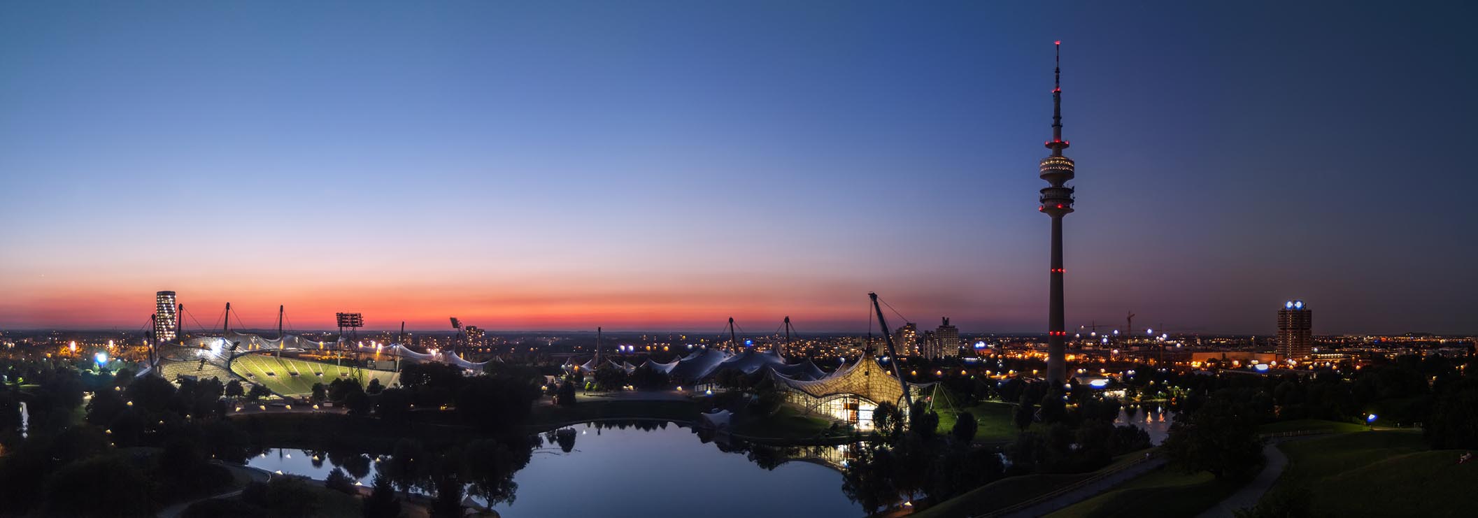
This panorama shows the Olympic Park in Munich about an hour after sunset. The original panorama was stitched from seven portrait oriented images. The final dimensions are 8443×2938 pixels.
Show on map
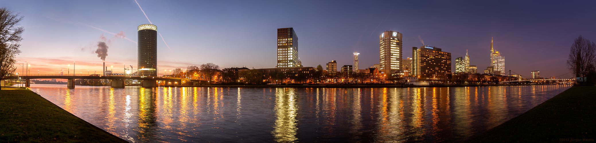
This is the very first panoramic image which I shot with my first DSLR camera. I used a tripod and took eight images in portrait orientation. The size of the resulting image is 12466 x 3000 pixel.